
TAP FOR MENU
Have a business, organization or event
you'd like to have listed on our site? Call us at
262-339-7850 or email info@mylocalpage.us.
LOCAL BUSINESS
LOCAL VIDEO
LOCAL MUSIC
LOCAL CALENDAR
LOCAL INTEREST
LOCAL MAP

WASHINGTON COUNTY
PARKS and TRAILS
Washington County has an amazing park and trail system with over 1200 acres accessible for hiking, fishing, picnicking and outdoor sports, not to mention the many town and village parks and state wildlife areas that exist within our borders.
Get out there and enjoy some of what Washington County has to offer!
Ackerman's Grove
Ackerman's Grove is a 73 acre county park that abuts the southeastern edge of 246 acre Little Cedar Lake in the Town of Polk. It is located about 7½ miles southwest of West Bend off of Cty Hwy Z.
It offers a trailered boat launch to the lake, fishing pier, a small sand beach with picnic areas, playground equipment, 3 reservable shelters, a half-mile walking trail, and heated flush restrooms.
CLICK HERE TO OPEN A PRINTABLE PARK MAP.
CLICK HERE TO GO TO THE PARK'S WEB PAGE.
Cedar Lake Wayside
Cedar Lake Wayside is a 3 acre county dog off-leash park located at the intersection of Cty Hwy NN and Z between Little and Big Cedar Lakes in the Town of West Bend. It is located about 3½ miles southwest of West Bend.
It is partially wooded with picnic areas and a portable restroom.
CLICK HERE TO OPEN A PRINTABLE PARK MAP.
CLICK HERE TO GO TO THE PARK'S WEB PAGE.
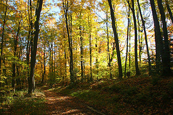
Eisenbahn State Trail
The 25 mile-long Eisenbahn State Trail runs from West Bend through Kewaskum and Campbellsport, ending in Fond du Lac county at the village park in Eden, WI. It is built upon the railroad grade of the Fox Valley & Western rail line which was abandoned in 1999. The southern 5 miles are paved passing through West Bend while the remaining trail is crushed limestone.
The map above shows the trail's South end.
CLICK HERE TO OPEN A PRINTABLE MAP OF
THE WASHINGTON COUNTY SEGMENT.
CLICK HERE TO GO TO THE TRAIL'S WEB PAGE.
Family Park
Family Park is a 15 acre county park located at the northeast corner of the Washington County Golf Course, just northeast of the city of Hartford.
Surrounding a pond used to irrigate the adjacent golf course is a 0.3 mi walking trail and open-air arboretum with labeled trees and shrubs. The park also features a picnic area, shelter, playground equipment, and a sand volleyball court.
CLICK HERE TO OPEN A PRINTABLE PARK MAP.
CLICK HERE TO GO TO THE PARK'S WEB PAGE.
Glacier Hills
Glacier Hills Park is a 140 acre county park located just west of Freiss Lake about 5½ miles west of Richfield.
It offers picnic areas, a playground, basketball and volleyball courts, and five walking trails from 0.6mi to 2.8mi that lead through scenic wooded areas and grasslands.
CLICK HERE TO OPEN A PRINTABLE PARK MAP.
CLICK HERE TO GO TO THE PARK'S WEB PAGE.
Goeden Park
Goeden Park is a roughly 7 acre county park located adjacent to the Milwaukee River at the southeast of the intersection of Cty Hwy M and Hwy 33, about 2½ miles east of the West Bend airport.
It offers a picnic area, a playground, restroom and reservable shelter, a short 0.2 mi wooded walking trail, and canoe access to the Milwaukee River.
CLICK HERE TO OPEN A PRINTABLE PARK MAP.
CLICK HERE TO GO TO THE PARK'S WEB PAGE.
Henscke Hillside Lake Access
The Henscke Hillside Lake Access is a part of the Washington County Park System and provides public access to Silver Lake, located less than 1 mile to the southwest of West Bend.
It offers a lit parking lot with five trailer length parking spaces and a heated restroom.
CLICK HERE TO OPEN A PRINTABLE PARK MAP.
CLICK HERE TO GO TO THE PARK'S WEB PAGE.
Heritage Trails
Heritage Trails Park is a 234 acre county park located just over 2½ miles south of Slinger and is accessible from Cty Hwy E.
It offers a picnic area, playground, restrooms and a shelter, and three walking trails from 1 to 2 miles in length leading through scenic wooded areas and grasslands.
CLICK HERE TO OPEN A PRINTABLE PARK MAP.
CLICK HERE TO GO TO THE PARK'S WEB PAGE.
Homestead Hollow
Homestead Hollow is a 105 acre county park located just over 2 miles west of Germantown which is accessible from Freistadt Road.
It offers a picnic area and playground, restrooms and a shelter, and three walking trails from 1 to 2 miles in length leading through scenic wooded areas and grasslands. In winter the park is available for cross-country skiing, as well as having a sledding hill and ice skating pond.
CLICK HERE TO OPEN A PRINTABLE PARK MAP.
CLICK HERE TO GO TO THE PARK'S WEB PAGE.
Leonard J. Yahr
38 acre Leonard J. Yahr County Park is located about 6 miles northeast of West Bend, on the north shore of Erler Lake.
It offers a substatial picnic area, playground equipment, a medium-sized sand beach, a carry-in boat launch and fishing pier, heated restrooms, 2 reservable shelters, and short walking trails and grass paths leading through wooded areas and grasslands.
CLICK HERE TO OPEN A PRINTABLE PARK MAP.
CLICK HERE TO GO TO THE PARK'S WEB PAGE.
Lizard Mound
Lizard Mound County Park is located about 2½ miles northeast of West Bend, off of Cty Hwy A.
It offers 2 picnic areas, portable restrooms, an interactive interpretive center with signs and audio recordings telling the story of the mound builders, and multiple paths leading through wooded and open areas allowing you to view 28 effigy mounds that archaeologists estimate are between 800 and 1300 years old.
CLICK HERE TO OPEN A PRINTABLE PARK MAP.
CLICK HERE TO GO TO THE PARK'S WEB PAGE.
PLEASE NOTE: Mounds in the park are listed in the U.S. National Register of Historic Places. It is illegal to disturb the mounds at this site.
Please stay on the trails when visiting the park.
Ridge Run
Ridge Run is a 140 acre county park located on the west side of West Bend, just to the west of the UW- Washington County campus.
It has north and south entrances, and different areas of the park offer basketball, tennis, and volleyball courts, a horseshoe area, fitness and playground equipment, picnic areas with flush restrooms,4 walking trails ranging from 1 to 1½ mi. long, and cross-country skiing, sledding, and ice skating in the winter. Follow the links below for more information.
CLICK HERE TO OPEN A PRINTABLE PARK MAP.
CLICK HERE TO GO TO THE PARK'S WEB PAGE.
Sandy Knoll
Sandy Knoll is a 267 acre county park located about 2 mi. northeast of West Bend.
Different areas of the park offer basketball and volleyball courts, a horseshoe area, playground equipment, picnic areas with flush restrooms, 4 reservable shelters, 5 walking trails ranging from ½ to 1½ mi. and a sand beach on a roughly 3½ acre pond. Cross-country skiing is available in the winter. Follow the links below for more information.
CLICK HERE TO OPEN A PRINTABLE PARK MAP.
CLICK HERE TO GO TO THE PARK'S WEB PAGE.
Copyright © 2017 Imagewërks LLC